


Perkinston Voting District, Stone County, Mississippi
About
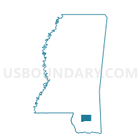
Outline

Summary
| Unique Area Identifier | 606685 |
| Name | Perkinston Voting District |
| County | Stone County |
| State | Mississippi |
| Area (square miles) | 24.66 |
| Land Area (square miles) | 24.61 |
| Water Area (square miles) | 0.06 |
| % of Land Area | 99.77 |
| % of Water Area | 0.23 |
| Latitude of the Internal Point | 30.77814250 |
| Longtitude of the Internal Point | -89.20071110 |
Maps


Graphs
Select a template below for downloading or customizing gragh for Perkinston Voting District, Stone County, Mississippi


Neighbors
Neighoring Voting District (by Name) Neighboring Voting District on the Map
- American Legion Voting District, Stone County, MS
- Elarbee Voting District, Stone County, MS
- Magnolia Voting District, Stone County, MS
- McHenry Fire Station Voting District, Stone County, MS
- McHenry Library Voting District, Stone County, MS
- Ten Mile Voting District, Stone County, MS
- Tuxachanie Voting District, Stone County, MS
Top 10 Neighboring County Subdivision (by Population) Neighboring County Subdivision on the Map
- District 4, Stone County, MS (4,099)
- District 3, Stone County, MS (3,965)
- District 2, Stone County, MS (3,287)